

Flowing south through the length of Brampton on its way to Lake Ontario, the Etobicoke Creek has been a major recreational, industrial and environmental resource since the municipality was founded in the early 19th century.
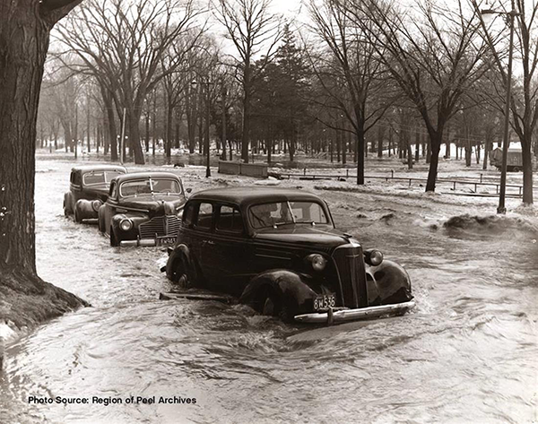
It has also been the source of major flooding and damage, most notably a particularly devastating 1948 event that inundated the downtown area with six feet of water and caused nearly $500,000 in damages.
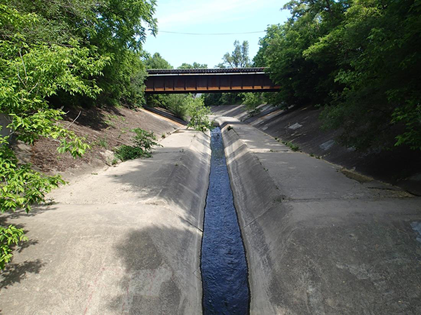
To prevent a repeat of that tragedy the-then Town of Brampton diverted the river into a concrete channel in 1952.
Now, a new chapter in the history, form and function of the Etobicoke Creek is unfolding.
Described by officials as a “once-in-a-generation investmentâ€� the City of Brampton’s two-phase Downtown Brampton Flood Protection Works (Riverwalk) – Phases 1+StatusUnder ConstructionValue$13.6MLocationBrampton, ON L6R 2K7SectorPublic – CityTypeWater / SewerData as of July 24, 2026 is a massive, multi-year transformative project that will dramatically alter the creek and the appearance of the downtown.
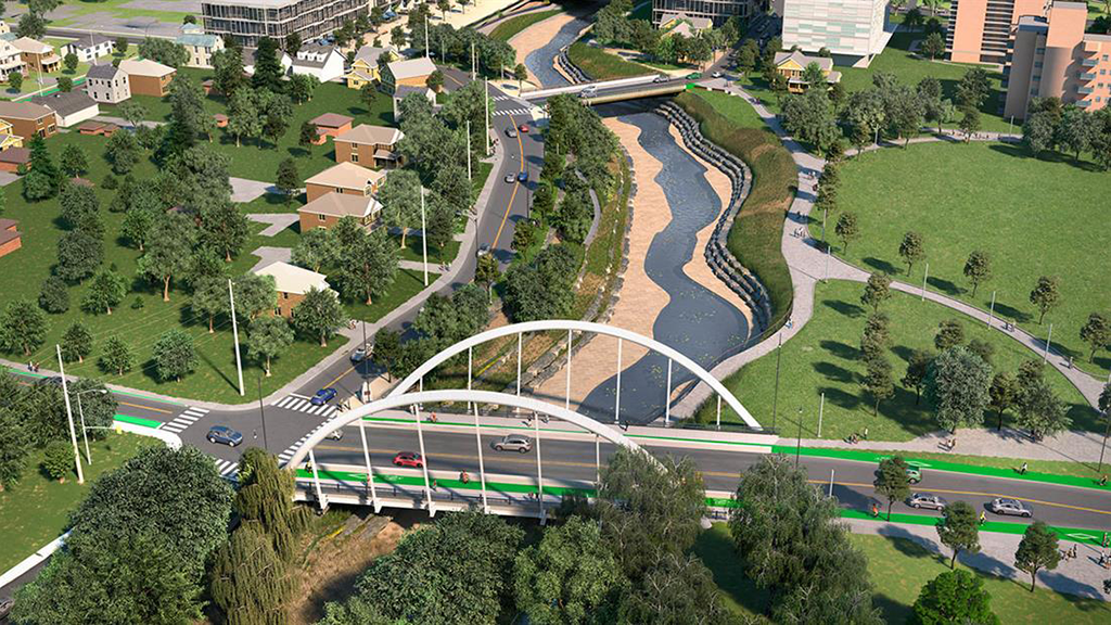
As part of an overall goal to reduce flooding, exceed Ontario’s Regulatory Flood Standards and support housing and economic growth, the project encompasses an extensive widening and deepening of the existing 1952 channel, along with major bridge and road work.
Planning for Riverwalk began in 2011 with a number of feasibility studies, planning amendments and economic studies aimed at identifying a long-term solution to address flood risk and unlock the redevelopment potential of downtown Brampton, says its planning, building and growth management commissioner, Steve Ganesh.
From 2018 to 2025 the project progressed through environmental assessments, technical studies, detailed design and consultation with residents, businesses and regulatory agencies such as the Toronto and Region Conservation Authority.
The objective was to develop an extensive environmental mitigation strategy that balances flood protection objectives with the enhancement of the Etobicoke Creek corridor, says Ganesh.
“Riverwalk is one of the most significant flood protection and city-building projects currently underway in Ontario and can be compared to other transformative flood mitigation initiatives, such as Toronto’s Port Lands Flood Protection Project.�
The project will be divided into two phases, with the current phase one focused on flood protection through the channel widening and deepening.
Once phase one is completed in 2028, the city will begin implementing the second phase urban design master plan which calls for the development of new parks, open spaces, trails, homes and business areas along the creek, he says.
Preliminary construction began in the fall of 2025. AECOM is the lead engineering consultant and EllisDon is the construction manager.
Currently, crews are working on utility relocation and the demolition of a number of city-owned properties.
The project requires the building of a new Ken Whillans Drive to the west of the current roadway and that construction is expected to get underway shortly.
As for the actual channel widening and deepening, that is scheduled to begin late this fall, take two years to complete and cover an approximately 600-metre-long stretch from just north of Church Street to John Street in the downtown core, says the city’s director of environmental engineering, Michael Heralall.
The channel will be widened from 20 to 50 metres at the top of the valley and excavated 1.2 metres, at the deepest point, from its existing top-of-the-valley height of eight metres.
This component of the work will also include removing the 75-year-old concrete and the installation of new concrete panels and armoured rock walls throughout as the channel is reconstructed, he says.
It will be an undertaking that will require utilizing a long list of heavy equipment including excavators, loaders, dump trucks, drill rigs, cranes, concrete removal and concrete making and pouring equipment, water trucks, dewatering units and pumps, says Heralall.
The project comes with more than a few challenges.
In addition to the need for a new Ken Whillans Drive, three new higher and wider bridges will be needed at Church, Scott and Queen Streets.
Installation of the 38-metre-long, 16 metre-wide, two-lane Church Street Bridge will occur this year, with the other two planned for 2027. Reflecting the fact Queen Street is Brampton’s major east-west thoroughfare, the Queen Street Bridge will be 35 metres long and 26 metres wide and have four lanes of traffic, with separated pedestrian/bike lanes.
As for the Scott Street Bridge, it will be 33.5 metres long and 12 metres wide, with two lanes of traffic, a multi-use path and a sidewalk.Ìý
A pedestrian bridge south of the CN rail line will also have to be replaced.
To be enhanced with adjacent landscaping when all the construction is completed, the corridor will include a low-flow channel that will facilitate the steady stream of the Etobicoke Creek.
In the event of a heavy storm, water will overflow into larger concrete/rock faced channel, says Heralall.
According to information posted on the city’s webpage, preliminary project cost estimates for the flood protection work is $106 million. The estimated costs for the second phase urban design master plan related projects have yet to be determined.
Recent Comments
comments for this post are closed